Water at a glance
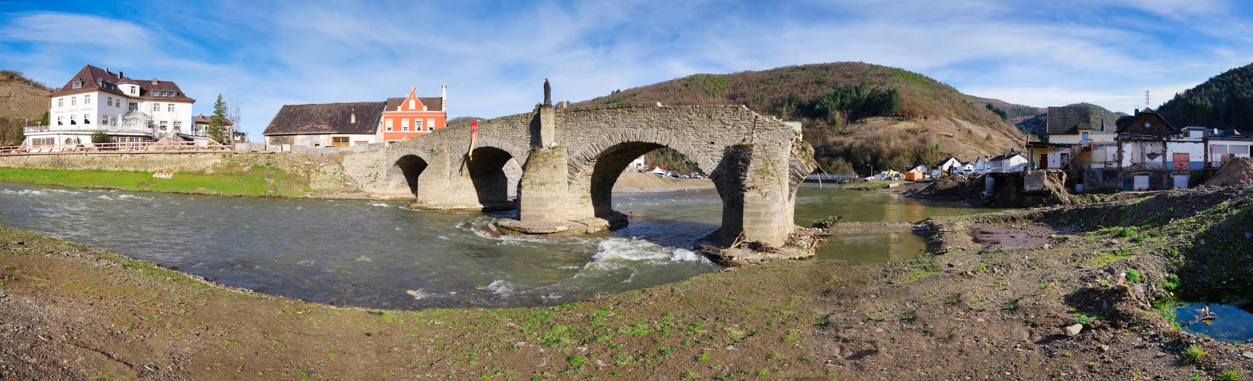
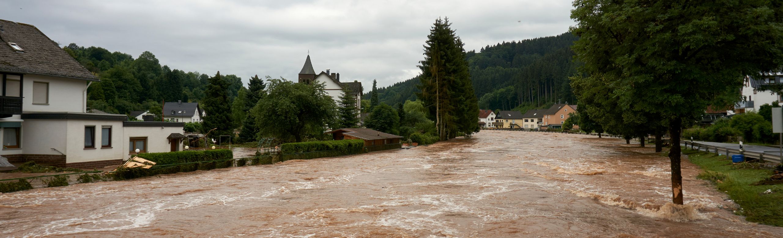
Climate change has a global impact on the occurrence of extreme weather events. Climate change is increasing the risk of extreme rainfall, which can lead to flooding. There is an increased risk of flooding, particularly in river basins with populated areas and intensive agriculture. The masses of water can cause considerable social, material and economic damage to entire regions.
In view of the increase in extreme weather events, adaptation to climate change is of great importance. This includes various measures such as improving flood protection, creating floodplains, renaturalising rivers and raising public awareness.
In addition to these measures, effective early warning systems are of crucial importance. Improved forecasts and warnings allow evacuations and protective measures to be initiated in good time.
With our Control Cloud in the field of water monitoring, you always have a 100% overview of your water resources. Our service package includes everything from conceptual design and customised setup of the Control Cloud to maintenance of the technology.

Conceptual design
The concept describes the possible realisation of a water monitoring system and includes the following service package:

Installation of measuring points
Customised setup of the Control Cloud including self-learning artificial intelligence
- Learns the behaviour of the water level in the further course of the river
- Analyses weather data and soil moisture values
- Integrates online and real-time weather data
- Issues forecasts
- Reports limit violations
- Dynamic monitoring network
- Connection to apps possible
- Visualisation of the measuring points in an online map service
- Interactive map that supports route planning
- Measured value and status display within the smart map
- Mobile access at any time
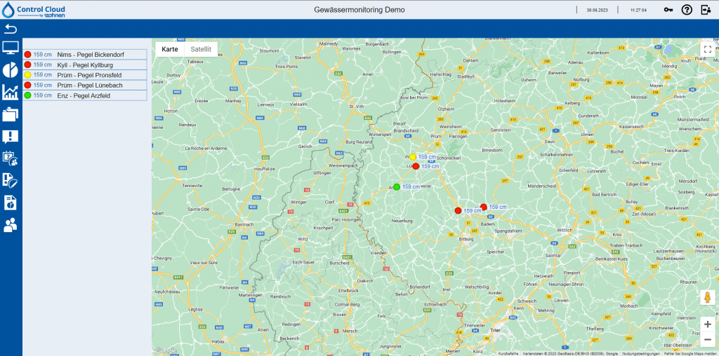
The water levels can be called up at any time via the water level map
The alerting chains could look like this, for example:
- Voice call to: Disaster control centre
- Voice call to: Head of disaster control centre
- Voice call to: District administrator of the district
- Voice call to: Fire brigade control centre
- Voice call to: State Office for Civil Protection
- Voice call to: Other institutions or persons

Maintenance and service
Benefits of the Control Cloud by zahnen
) (500 × 500 px)")
Your contact: Manuel Wahl